Thomas Dugdale
Author /
Editor of Curiosities of Great Britain (1835) which became England
and Wales Delineated when republished in the 1840s.
During the
late 1700s and 1800s there were many gazetteer guides which attempted to describe
the British Isles and many of these included maps and / or illustrations. Two
good examples of this genre are the books published as monthly instalments by
Fisher – Devonshire and Cornwall Illustrated – and by Jennings – Moore´s
History of Devonshire – which both included a wealth of written material
on the county/counties and included maps and, more importantly, engravings. See
my blog, Jennings vs. Fisher for full details and all the illustrations.
Thomas
Dugdale was possibly an amateur historian, genealogist, geographer and
antiquarian and was mostly responsible for compiling the Curiosities of
Great Britain. This work was first published in 1835 and included maps
produced by the team of George Cole, artist and cartographer, and John Roper,
an engraver. These maps first appeared in the work The Beauties of England
and Wales which was published 1803-1805. Later the maps were collected into
an atlas, The British Atlas, published just once in 1810.
In 1816 the
Rev. J Nightingale´s English Topography exploited the maps to illustrate
his gazetteer guide to England. The book seems to have been printed at least
twice and issued by two different publishers (with changes to some maps) and
one of these publishers reissued the work circa 1827 with the same title.
Curiosities of
Great Britain was first published in 1835 and again circa 1840
with text by Thomas Dugdale, numerous engravings and the original maps by Cole
and Roper. He was assisted in the compilation by William Burnett, a civil
engineer. About this time the company of Tallis had taken over the remaining Cole
and Roper maps and used them until their stock was exhausted. Missing maps were
steadily replaced by maps by Joshua Archer. Archer was a prolific map engraver
at this time producing work for a variety of different publishers.
The Tallis
company, first John Tallis (d.1842), later Lucinda Tallis published Dugdale´s
work from c. 1835 until at least 1860 while simultaneously publishing a similar
work by the Rev. J Barclay (Barclay´s Universal Dictionary) and a Topographical
Atlas of England and Wales, all exploiting the maps engraved by Archer.
Consequently, neither the Curiosities nor the Archer maps are
particularly rare.
The maps are
fine examples of Victorian mapmaking: approximately A4 size with county boundaries,
market towns, fine detail and roads, rivers and canals. The railways are shown,
but in an attempt to be up-to-date they often show rail lines that were never
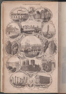
built. The work was richly illustrated with over 200 views showing monuments,
historical buildings and towns including many birth places of famous artists
and writers.
The complete
work when finished was published in various numbers of volumes but the complete
work included an 11th volume, An Alphabetical Chronology of
Remarkable Events, by Leonard Townsend. Dugdale´s text runs to over 1500
pages and can be viewed as part of the Gutenberg Project on-line at: https://www.gutenberg.org/files/37519/37519-h/37519-h.htm.
The maps and views are also present but the latter are not very good quality.
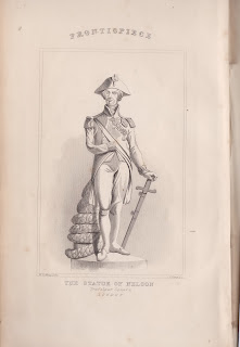
The following illustrations are from an 11-volume set in my collection. I have
set them out as they appear in the eleven volume set. I will add the maps at a
later date.
This set is
for sale and a description and photos can be found here.
A separate
list consisting of the Devon and Cornwall views is included here.
If you require a better copy, contact me (e.g. book restoration, blog, research).
The 11 volumes: click the word Volume to access all the views.
Volume I - see below.
Volume XI - An Alphabetical Chronology of Remarkable Events by Leonard Townsend.


%20Knaresborough%20Castle.jpg)
%20Theberton%20House.jpg)
%20The%20Queen%C2%B4s%20Palace%20Pimlico.jpg)
%20City%20of%20Durham.jpg)
%20New%20Post%20Office.jpg)
%20New%20Royal%20Exchange.jpg)
%20Tretwr.jpg)
%20Fenrice%20Castle.jpg)
%20Laugharne%20Castle.jpg)
%20Vale%20of%20Taff.jpg)
%20Manerbeer%20Castle.jpg)
%20Goodrich%20Castle.jpg)
%20Cowbridge.jpg)
%20Llanthoney%20Abbey.jpg)
%20London%20Bridge.jpg)
%20Somerset%20House.jpg)
%20Kirkstall%20Abbey.jpg)
%20Runny%20Mead%20or%20Magna-Carta%20Island.jpg)
%20Knaresborough%20Castle.jpg)
%20City%20of%20Bristol.jpg)
%20York.jpg)
%20Carlisle%20Castle.jpg)
%20Westminster%20Abbey.jpg)
%20Dunstable%20Priory%20Church.jpg)
%20Plymouth%20Sound.jpg)
%20Goldsmiths%20Hall.jpg)
%20Bank%20of%20England.jpg)
%20Middlesex%20Hospital.jpg)

.jpg)
Comments
Post a Comment